
Liang Pei, Yang Liu. Construction Method of Real 3D Model of Heterogeneous Remote Sensing Images[J]. Laser & Optoelectronics Progress, 2019, 56(4): 042802
- Laser & Optoelectronics Progress
- Vol. 56, Issue 4, 042802 (2019)
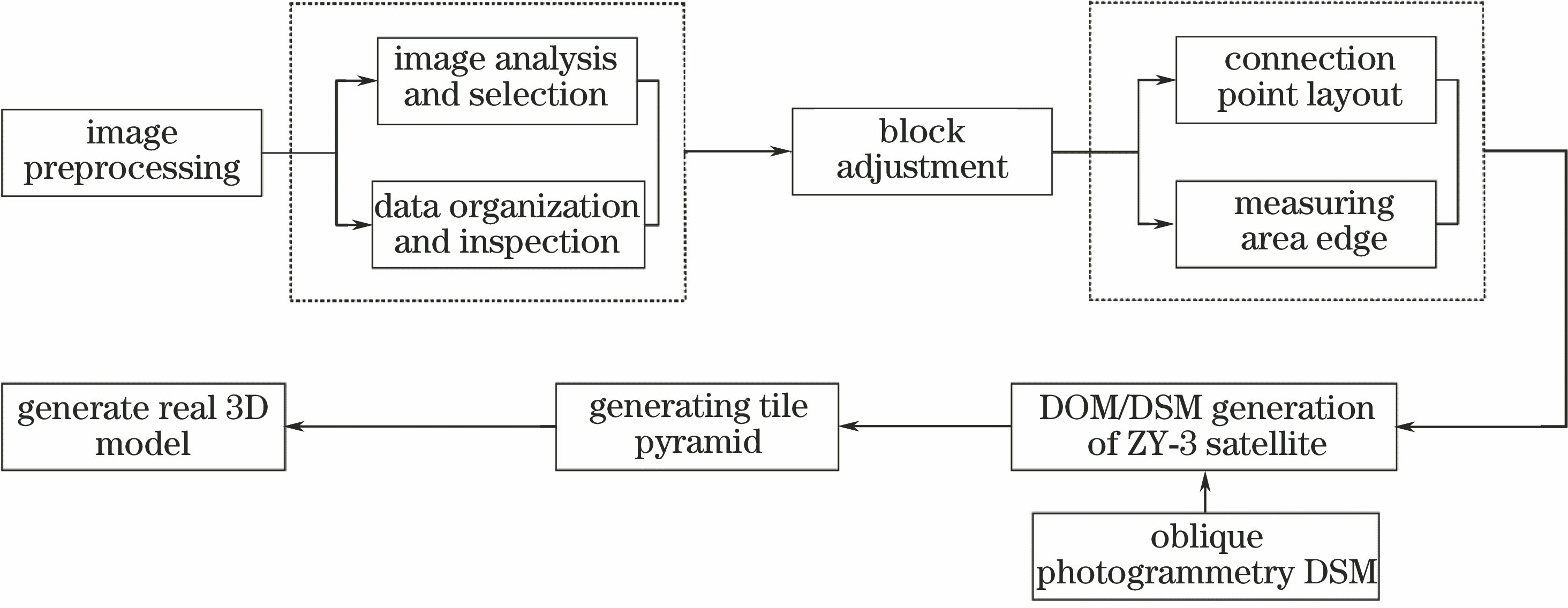
Fig. 1. Flow chart of overall technical route

Fig. 2. Structural diagram of pyramid model for multi-scale images
Fig. 3. Multiple types of images with different resolutions. (a) Image by oblique photogrammetric data; (b) image by satellite data; (c) image by oblique photogrammetry and satellite fusion
Fig. 4. Topographic map of research area in Hunan province
Fig. 5. Fused images. (a) Orthographic view; (b) side view
Fig. 6. Effect maps of real 3D image. (a) Effect map 1; (b) effect map 2; (c) effect map 3; (d) effect map 4
Fig. 7. Error statistics of real 3D model. (a) Error in X direction; (b) error in Y direction; (c) plane error; (d) elevation error
|
Table 1. Error precision statistics of real 3D model


Set citation alerts for the article
Please enter your email address

© Copyright 2018-2021 | Chinese Laser Press. All Rights Reserved 沪ICP备15018463号-20