• Acta Optica Sinica
  • Vol. 45, Issue 12, 1228003 (2025)
Xinglei Zhao1,*, Meili Zhu1, Kewen Hu1, and Fengnian Zhou2
Author Affiliations
  • 1School of Information Science and Engineering, Shandong Agricultural University, Taian271018, Shandong , China
  • 2Survey Bureau of Hydrology and Water Resources of Yangtze Estuary, Hydrology Bureau of Changjiang Water Resources Commission, Shanghai 200136, China
  • show less
    DOI: 10.3788/AOS241688 Cite this Article Set citation alerts
    Xinglei Zhao, Meili Zhu, Kewen Hu, Fengnian Zhou. Water Extraction Based on Normalized Difference Water Index for Airborne LiDAR[J]. Acta Optica Sinica, 2025, 45(12): 1228003 Copy Citation Text show less
    Illustration of dual-frequency laser water/land measurement
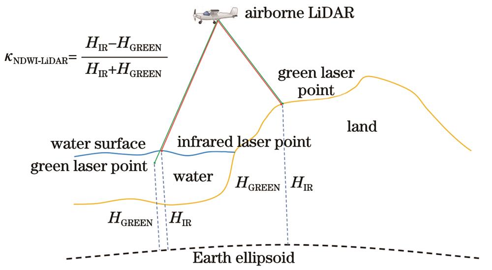
    Fig. 1. Illustration of dual-frequency laser water/land measurement
    Illustration of components in a green laser full-waveform of water
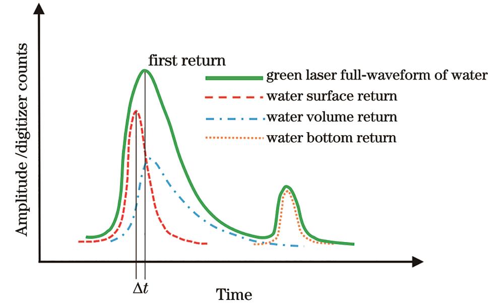
    Fig. 2. Illustration of components in a green laser full-waveform of water
    Relationships of various reference coordinate systems
    Fig. 3. Relationships of various reference coordinate systems
    Identification and removal of noisy surface points considering the adjacent laser point pulse number
    Fig. 4. Identification and removal of noisy surface points considering the adjacent laser point pulse number
    Flowchart of the water extraction based on dual-frequency LiDAR point cloud and NDWI-LiDAR
    Fig. 5. Flowchart of the water extraction based on dual-frequency LiDAR point cloud and NDWI-LiDAR
    Location of the airborne LiDAR experiment
    Fig. 6. Location of the airborne LiDAR experiment
    Point clouds of infrared and green lasers. (a) IR laser point cloud; (b) green laser point cloud
    Fig. 7. Point clouds of infrared and green lasers. (a) IR laser point cloud; (b) green laser point cloud
    Local probability density distribution of infrared and green laser point elevations
    Fig. 8. Local probability density distribution of infrared and green laser point elevations
    Spatial distribution of NDWI-LiDAR values in the experimental area
    Fig. 9. Spatial distribution of NDWI-LiDAR values in the experimental area
    Probability density distribution of NDWI-LiDAR in the experimental area
    Fig. 10. Probability density distribution of NDWI-LiDAR in the experimental area
    Water/land identification results based on NDWI-LiDAR. (a) Raw water points; (b) corrected water points; (c) raw land points; (d) corrected land points
    Fig. 11. Water/land identification results based on NDWI-LiDAR. (a) Raw water points; (b) corrected water points; (c) raw land points; (d) corrected land points
    Comparison of water extraction results by two LiDAR point clouds. (a) RANSAC; (b) NDWI-LiDAR
    Fig. 12. Comparison of water extraction results by two LiDAR point clouds. (a) RANSAC; (b) NDWI-LiDAR

    Water extraction method

    based on LiDAR point cloud

    Number of misidentified pointsBias of land-water interface
    Max. /mMin. /mMean /mStd. /mSSIM
    RANSAC1053050.308.86.70.89
    NDWI-LiDAR139225.204.24.20.92
    Table 1. Comparisons of two LiDAR point cloud-based water extraction methods
    Xinglei Zhao, Meili Zhu, Kewen Hu, Fengnian Zhou. Water Extraction Based on Normalized Difference Water Index for Airborne LiDAR[J]. Acta Optica Sinica, 2025, 45(12): 1228003
    Download Citation